We have spent the past week paddling on Lake Athabasca. After making our way off of the Tazin River through a series of lakes and portages, we came out onto the big lake near the community of Camsell Portage. It is a very small town, but they do have all the modern conveniences – electricity thanks to nearby hydroelectric dams, phone service, and even internet via satellite.

Dave and I were thrilled to have a chance to spend some time talking with Phillip and Mary Stenne. We learned about life in Camsell Portage back in the old days. It used to be much bigger when the El Dorado mine near Uranium City was functioning. That is actually what brought Phillip to the area 60 years ago, but he left the mine rather quickly in favor of living in Camsell Portage, fishing, trapping, and cutting survey lines for mineral exploration. Now Mary and Phillip are 2 of the 8 people living in this tiny town.
We left Camsell Portage in a light headwind. Little did we know that headwind, from the east would be with us basically the entire way. The north shore of Lake Athabasca reminded us very much of home – that is, the north shore of Lake Superior. The coast is almost entirely granite. Wave action keeps even lichen from growing on several meters of the pink rock along shore. We have enjoyed the varied scenery of many points, bays, and islands.

Being out on this big body of water, it has been a great spot to view the surrounding landscape, enjoying seeing the green healthy spruce and jack pine in patches. However, we have also seen several large sections that have burned not too long ago. Just a little dusting of green shrubs are visible among the blackened rock and standing dead timber, as the forest slowly returns.
We chose to take a short cut near Uranium City, following the river and a series of lakes through the peninsula instead of paddling all the way around. This way was significantly shorter, but the water in the river was really low and we portaged a bit more than we would have liked. It was a relief to cut from Beaver Lodge Lake, following the winter road, back out to Lake Athabasca.

Since the shortcut, we have been on an evening paddling schedule in order to avoid the stronger wind that seems to pick up during the day. This works well, as it never gets completely dark. The sun dips below the horizon around 10:30 PM but there is still a faint glow in the northern sky until the sun rises around 3:30 AM. Fennel has been well fed on fish. The other day, Dave caught a really big lake trout – the biggest one he’s ever caught.
We passed by Fon du Lac, stopping briefly to pick up a couple treats at the grocery store. Last night we paddled through Pine Channel and now we are within a day’s paddle of Stony Rapids. From there we will leave the big water behind for a while.
Have you ever seen a forest fire up close? Well we hadn’t until this past week. On Tuesday as we left Hill Island Lake, we could see smoke toward the south but we figured that it was a long ways away. On Wednesday, the plumes of smoke grew closer and closer as we paddled south on the Tazin River.

By lunch time we were pretty sure that the fire was near our route. The view upriver was one thick, low-lying cloud of smoke. We called the ENR (Environment and Natural Resources) in Fort Smith to see if they knew of any fires in our area. We found out that there were three fires not very far away from us. The one of concern was burning near the Northwest Territories, Saskatchewan border.
We were about five miles from the border. We proceeded with caution, but only made it another couple of miles after lunch. The eastern side of the river was on fire. Not only did we see thick clouds of smoke billowing up from the spruces, but we saw patches of flames here and there. Fortunately for us, the wind was blowing the smoke away from us.
A gravel bar provided us with a perfect spot to stop and watch what was going on upriver. We waited there for several hours. We set up our tent and ate dinner as we observed the smoke and flames creep ever closer to the eastern shore of the river. After several hours the fire had reached the river’s edge and a small stand of Jack Pine ignited in a plume of flames and smoke. In less than a minute the ¼ mile section of the river near us had erupted in flames. The raw energy of the fire became very real as we felt the heat and listened to the inferno. All we could to is stand in awe.

Within 10 minutes the flames were gone, leaving a giant stand of black smoking tree trunks. We decided the fire was getting too close for comfort so we packed up the canoe and retreated north, hoping the fire would die down overnight and let us pass in the morning.
As we slept the fire jumped the river and continued burning to the west. Small fires burned on both sides of the river and the smoke-filled river channel was not very inviting. We called the ENR again and learned that they were sending a helicopter out later in the day to get a look at the fire. So we decided to take it easy and wait. Around 3 PM we heard the drone of the chopper and watched as it came in for a landing on the gravel beach 100 feet from us. Two ENR officers in yellow jumpsuits hopped out and explained that the fire had burned out along most of the river and that the “head” of the fire had moved several miles west of the river. They advised that we paddle through the recently burned area right way because the winds were predicted to change overnight.

We casually chatted for a few minutes and then they hopped back in the helicopter and flew way. We were left a little dumbfounded, but excited about continuing our journey. As we paddle through the smoke filled channel, we marveled at the blackened trees and patches of green left by the fire. Small fires still burned on both sides of the river, but we never felt in danger. We paddled well into the night talking about the natural phenomenon we had just witnessed, finally stopping to pitch out tent many miles from the fire at 1 AM.
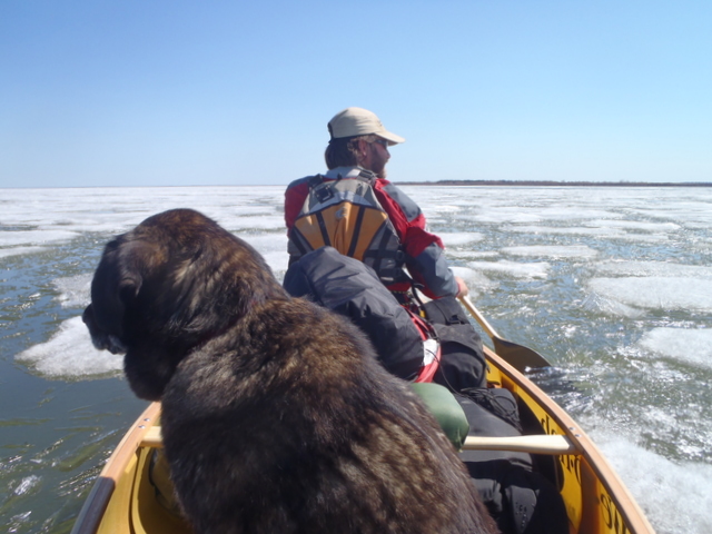
It turns out that the end of May is a little too early to start paddling on Great Slave Lake in the Northwest Territories. Ice stretched to the horizon and much of our time was spent wading and dragging the canoe through shallow open water and pushing, prying, and breaking our way through the candle ice. It was sort of fun for a few days, but mostly it was a lot of work.
Video on Vimeo of breaking through the ice
On Earth Day (April 22) of 2010 Dave Freeman and I began a three year, 11,700 mile journey across North America by kayak, canoe and dog sled. Our goals are to increase awareness and promote conservation of North America’s waterways and wild places while actively engaging over 100,000 elementary and middle school students in the journey though our website and live school assemblies.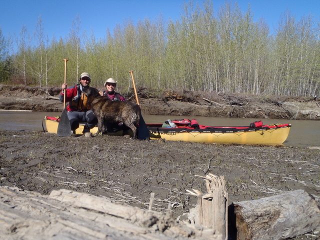
The odyssey began by kayak on the Pacific Coast studying temperate rainforests and marine life of the Pacific Northwest, but this was just the first in a series of six stages on their quest to highlight North America’s wildest places.
After kayaking 1,400 miles from Seattle, Washington to Skagway, Alaska, we progressed over the history-studded mountains in the footsteps of the Klondike Gold Rush, to the Mackenzie River delta. From there, we dog sledded south and are currently canoeing from Great Slave Lake toward Ontario. Then we will kayak through the Great Lakes and follow the annual whale migration past the salt marshes and sea turtles of the Atlantic Coast, finishing in the mangroves and coral reefs of the Florida Keys.
As you read this, we are somewhere in central Canada, working our way south and east in our canoe with our travel companion and favorite sled dog Fennel. To follow our progress and virtually immerse yourself in the expedition, check out www.NorthAmericanOdyssey.com. We are very excited to join the Palm Equipment Team and we will post regular updates on the blog.


