For nearly a year I’d had been planning and working on a youth kayak expedition to the Ladakh area in Northern India, with a small group of dedicated and talented young people, with the objective of paddling the Zanskar River.
A few days before our departure, in the dead of night, rains brought havoc to the small town of Leh and the surrounding area, affecting 25000 people all over Ladakh. This was the same weather system that devastated Pakistan, displacing 14 million people. There was no way we could continue with our original plans to go to Leh, the town and area was devastated.
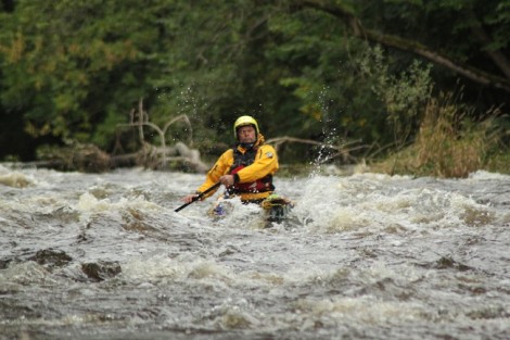
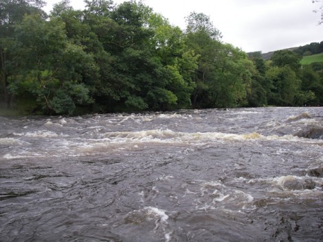
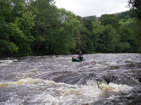
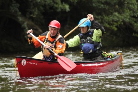
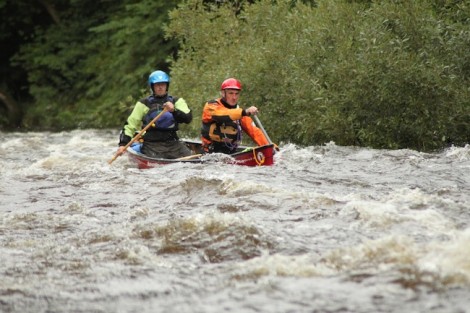
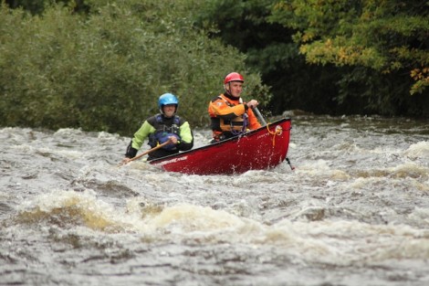
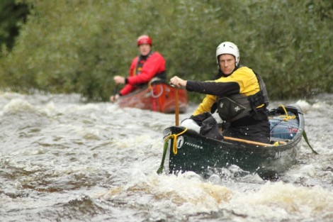
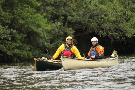
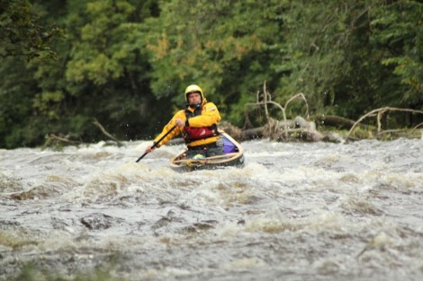
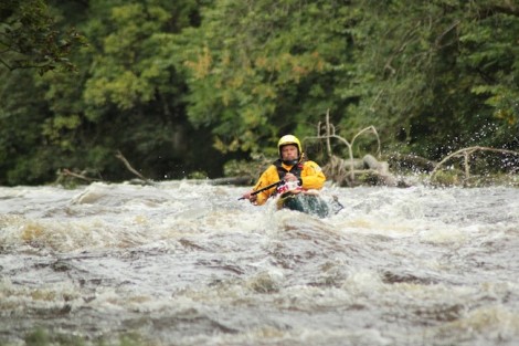
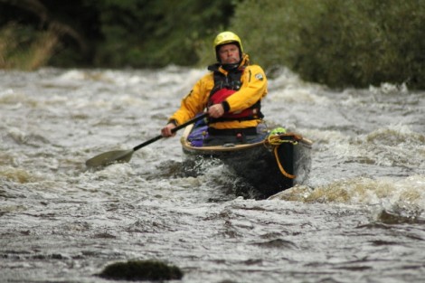
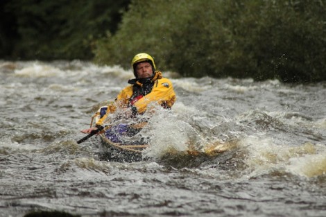
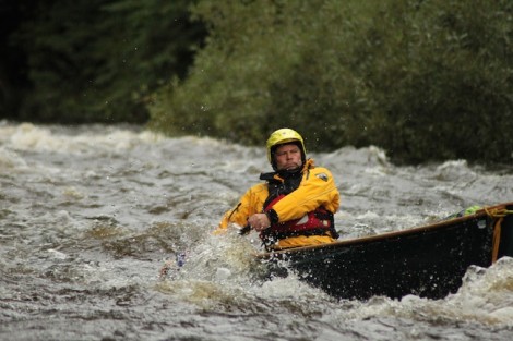
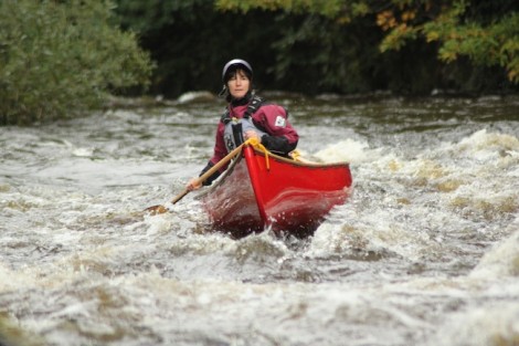
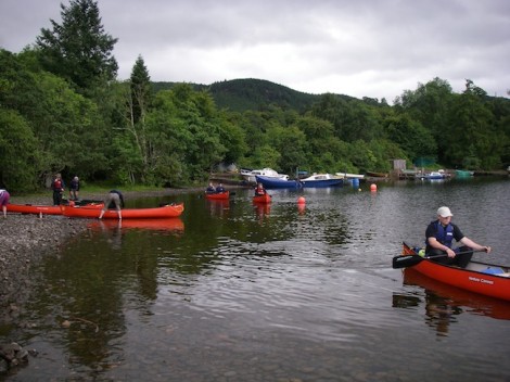
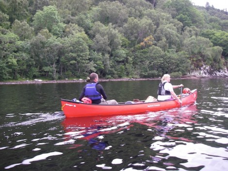
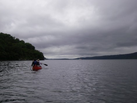
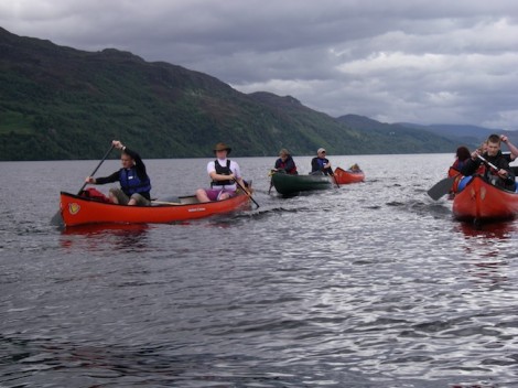
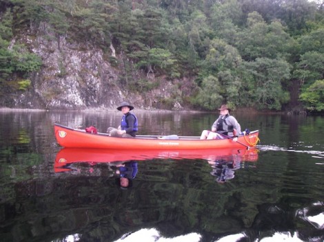
I sat at home looking for options for the group, not wanting to disappoint anyone, even though they were incredibly understanding, given the circumstances. I wanted to make something happen for the group and get them on the water paddling somewhere. The major problem that we had was that we had no money, all of our money was in India, and so any option of a quick trip to the Alps was impossible. I sat at home and checked the tides for the Bitches tidal race and the weather, the conditions were perfect. We quickly rescheduled and headed to Pembroke, where we had a stunning week and great conditions.
During that week, we were told that none of the participants would be covered for cancellation as it was regarded as a natural disaster. After two months with letters from lawyers, we finally managed to get paid out by the insurance company.
I am quite aware, that cancelling our trip and all of our own small logistical problems, are nothing of significance compared to what the people of Ladakh have had to deal with. But there were some key learning points, from this situation. Things don’t always go to plan and providing you are patient, persistent and have the ability to adapt, things can turn out well in the end, if you hang on in there!
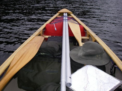
Hope you like the pictures form the Bitches; they were taken with a Mamiya 7 film camera.


If you would like to find out more about supporting the people of the Ladakh area, you can contact Aquaterra Charity Trust (ACT)
All the best, Deb
Deb Pinniger
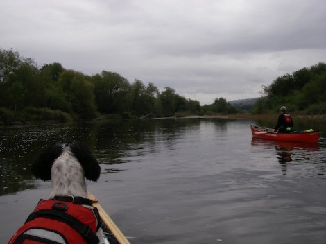
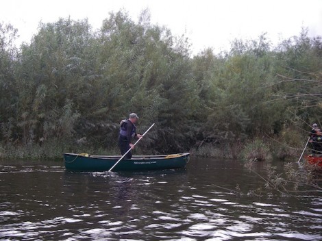
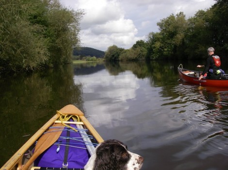
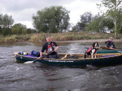
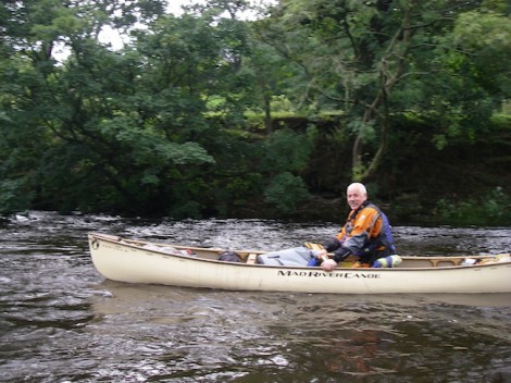
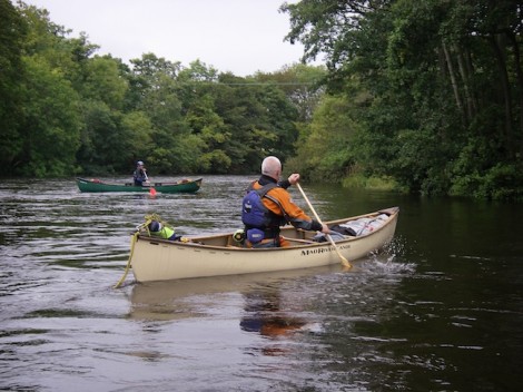
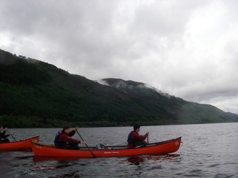
Last week I joined a couple of old friends Ken and Cilve for a trip from Glasbury to Hay on the River Wye in South Wales
The River Wye (Afon Gwy) is the fifth longest river in the UK and for parts of its length forms the border between England and Wales. Its source is in the Welsh mountains near Plynlimon and it is around 215 km in length. It flows through or near several towns and villages in South Wales including Rhayader, Builth Wells, Hay-on-Wye, Hereford, Ross-on-Wye, Symonds Yat and Monmouth finally meeting the Severn estuary just below Chepstow. Due to its slow flow it is a popular venue for canoeing especially for introducing beginners (grade 1-2), and hence the large number of local centers that use it. There also numerous company’s offering the hire of boats.
The area of Symonds Yat offers some more challenging paddling and the sections above Glasbury offer some good grade 3-4 rapids in the right conditions. This particular section from Glasbury to Hay is around 10 km in length and could be done in a couple of hours.
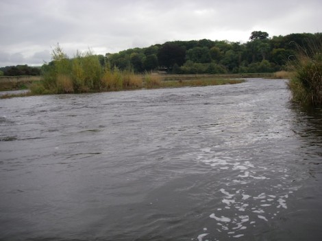
Tranquil surroundings near the start
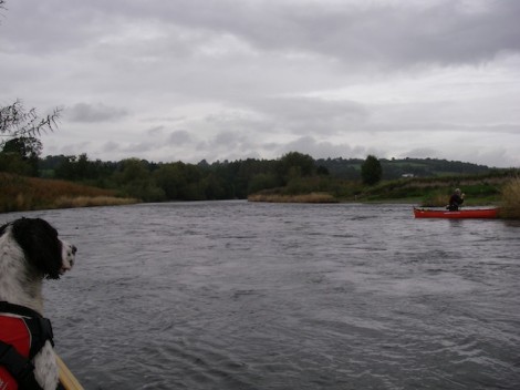
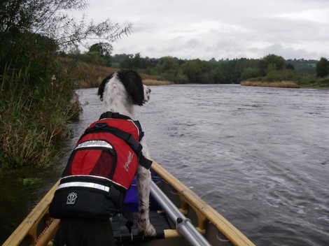
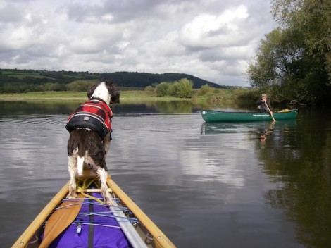
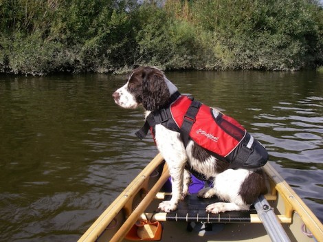
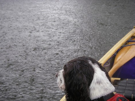
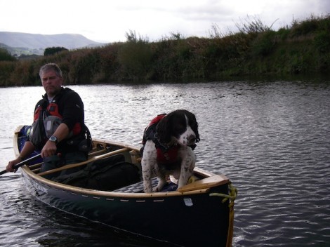
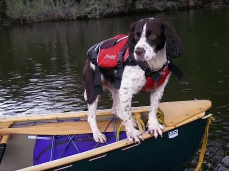
I was also accompanied on the day by trusted hound Rannoch. He is a five year old Springer Spaniel who just loves it in the canoe. He is real muck magnet, trust me when I say I could take him to the desert and he would find both mud and water! Inevitably the inside of my boat always ends up wet and very dirty. He doesn’t always get the chance to come on trips with me, but today was different. He is generally quite good in the boat and can be very useful addition for adjusting the trim when needed.
The rivers winds its way through the country side at a leisurely pace with the Black Mountains as a majestic back drop.
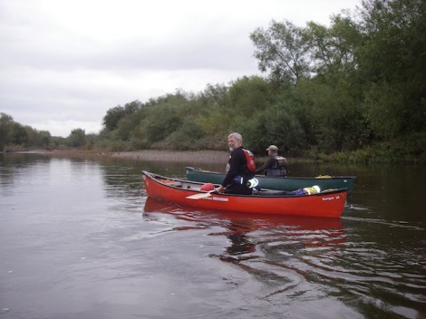
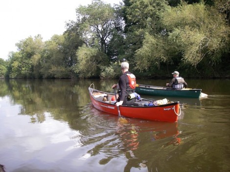
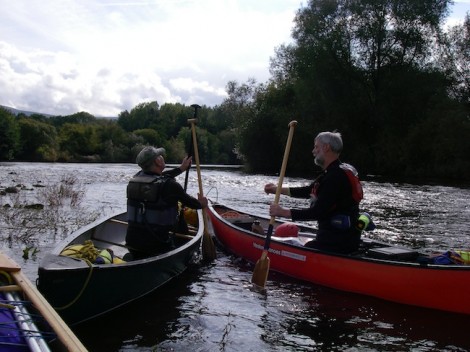
Ken and Clive
Rannoch keeping a watchful eye on the proceedings
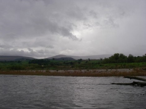
The Black Mountains in the distance
Despite the slow and tranquil flow of the river, some care should be taken as there are numerous dead and living trees in the river, forming quite large strainers. Carrying a folding saw is always a good idea.
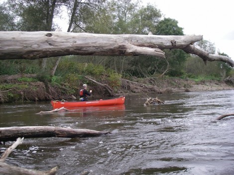
Ken and one of the many dead trees in the river
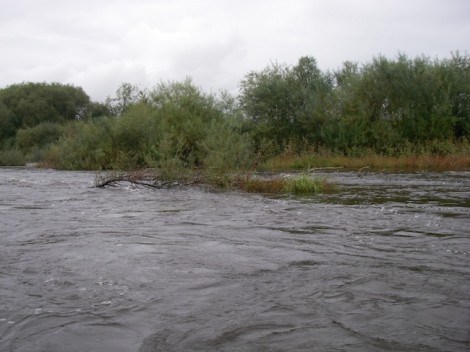
Th river has changed shape quite dramatically since I last paddled it a few years ago, with one large sweeping bend near the start now being replaced by a straight section. There are numerous opportunities to leave the main river and explore some the tributaries that join it. Good time to get the poles out me thinks!
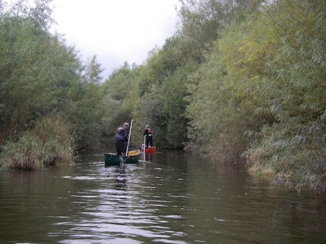
Ken and Clive off exploring
After a short stop for lunch we continued on our way. The weather had by now really improved and the sun was warming us nicely.
Rannoch offering Clive some coaching
Rannoch catching some rays
No, no mine is definitely bigger!
As we rounded a corner that led to a long straight the sun disappeared and it started to rain. In fact it started to pour down, so much so the rain was bouncing back up!
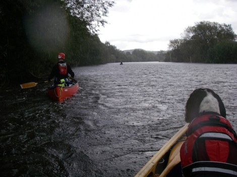
And so the rain started
A very un-impressed Rannoch
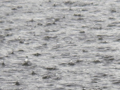
Bouncing rain!
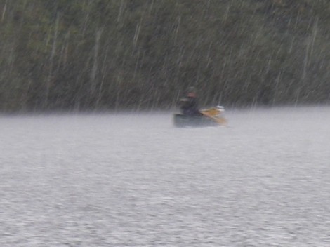
And then it rained some more
Then almost as quickly as it started, it stopped. We continued on our way past an old broken weir and on to the get out.
Rannoch on Iceberg watch
Approaching the old broken weir
Looking back up the river from the get out
The get out is directly after the bridge in Hay on river right. This can be quite busy with other users, especially groups.
I’m not sure if I have really done this trip a justice? It really is a great day out whether you’re looking for a relaxing days paddle or as a venue for introducing people to open canoe. The trip can be extended as much as you like or done as a multi day trip all the way to Chepstow. Wild camping is not really option but there are a number of campsites along the way, and pubs offering fine ales and good food. So if you haven’t done it yet, add it to your to do list.
I had a grand day out and so did Rannoch. Thanks to Ken and Clive for their company.
See you on the water…
Jules
www.voyageur-coaching.co.uk
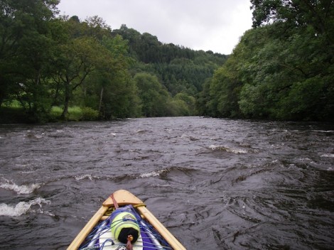
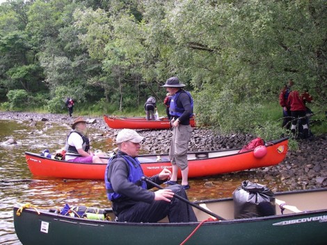
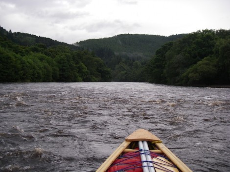
I recently had the pleasure of paddling from Glyndyffrdy to the Horseshoe Falls on the River Dee in North Wales. I was there to assess a number of candidates for the British Canoe Union (BCU) four star leader award in canoe. This award allows individuals to lead a group in moderate water conditions. Moderate water is defined as: large areas of open water (lakes,lochs) with winds up to force 4, and grade 2 rivers.
The River Dee or Afon Dyfrdwy as it is known in Welsh, starts in the hills south west of Bala and then flows for about 10 km before entering Bala Lake (Llyn Tegid). The canoeing sections start from below the lake and work their way through the country side to Llangollen. After this the river continues its path cross country, leaving Wales and entering England shortly before Chester, where it then flows flows into the sea. Access can be a problem on some sections, however this section is regularly paddled and parking is courtesy of a local farmer who charges a small fee for the pleasure.
As a an indication to the level on the day you can check the gauge at Mile End Mill. On this day it was on 11 proving good conditions of continuous grade 2.
Good conditions for this section
I was joined on the day by my friend and fellow coach Chris
My partner in crime Chris
This really is a lovely section of river at the grade. Large sections of grade 2 rapids, with waves to be surfed interspersed with short flat sections. Add to this the stunning scenery with the hills as a back drop. Around half way down a nice surf wave can usually be found, however at this level today it was washed out.
Flat section close to the get on
Approaching some rapids
Looking back up one of the rapids
One of the group conentrating hard
Unlike paddling a kayak open boaters have a real chance of swamping. This can be good fun if just messing about or on a short paddle, but if the boat was fully laden as for a multi day trip then it could become an issue. A useful strategy when running sections like this in open boat is to try and slow your self down, or check your speed in order to avoid swamping. Combine this with use of the reverse ferry and a clean or even dry line can be achieved. An alternative to this is, where you find a downstream ‘V’ or tongue is to adopt a style similar to the Voyageurs, who ran a line slightly to one side of the apex of the ‘V’ resulting in a drier descent. The line was know as a ‘filet d’eau’ or fillet of water.
Iain and David joined us for the day
I t was nice to see that a tandem crew joined us for the day, which gave he candidates on assessment a bit more to think about.
Andy one minute a paddlemaker, next a paddler!
As it was a leadership award Chris took it upon himself to discuss the different leadership styles with the group and introduced them to the lesser known style AMFYOYO!! This is only to be used in times when all else has failed, and stands for “Adios my friend your on your own!” I think we can all think of a situation when this was probably quite apt.
Leadership need not be difficult in this environment if a logical approach is taken to it. Ask your self a few simple questions:
Where do I want to go or be?
Can I see where I want to go or be? If not move somewhere you can
What hazards if any are between me and my destination, and how big a hazard do they pose?
Can the hazard/s be avoided or what can I do to lessen the result?
How many boats or swimmers can I deal with here at one time?
What style should I use? One at a time, eddy hop, leap frog etc
Remember if all else fails.. AMFYOYO, But don’t. quote me on that
Chris and I discussing the merits of AMFYOYO!
The day moved on and lots more fun was to had on the various sections of grade 2. A brief stop for lunch was followed by some nice rapids. Thank you to Simon (aka Redframe) for the following shots of myself doing what I enjoy.
There was then one last rapid that led to a slow flat section which gave us warning of the approaching Horse Shoe Falls. Great care should be taken on approaching the falls especially at this level as a powerful recirculation is formed below the weir. Egress early on river left and portage round, or if care is taken in lower conditions and keeping well clear of the weir there is the option of a sneak down the side.
In case you wondered, no this is not me! Its Sue strutting her stuff
This was all the fun over with for now. All that was left to do was to paddle down the canal to the Eisteddfod International Pavilion (small parking fee) where we had left the vehicles. Alternatively the river could be paddled further taking in the section of the Serpents Tale (grade 3 -4) and continuing down grade 2 rapids to the white water center at Mile End Mill.
The section described here from Glyndyffrdy to the Horseshoe Falls is approximately 10 km (6 miles) in length and is a really good day out.
A big thank you to all of that gave your time and joined me for the day.
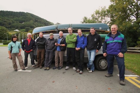
The motley crew
See you on the water…
Jules
www.voyageur-coaching.co.uk
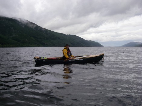
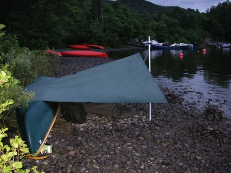
Day two started much as day one had ended, cloudy and overcast with a stiffening wind. I was awake at first light as usual and used this time to plan the day.
A dawn view from my tarp
Looking south from where we had come from
On waking I was quite surprised to notice the that the water that was some two feet plus away from my tarp the previous night, was now considerably closer. In fact I could actually lean out of my tarp and fill my mug from the loch. It had rained the day before admittedly, but with the loch the size it is I was surprised to see how much it had risen overnight. A good learning point for the future me thinks!
Leaving Foyers on day 2
Breakfast done and kit packed we set off hoping to make it to the end of the Loch on time, as planned for our pick up.
When tackling a multi day journey like this, some thought should be given as to how you carry your kit and load it into your canoe. As most of my journeying is solo I tend to adopt a three line system. First line is what I carry on my person or in my buoyancy aid, a bit like a small survival kit just in case I become separated from my boat and my main kit. This tends to be a good knife, a folding saw and a fire steel for lighting fire along with a bit of food (nibbles), simple first aid (electrical tape) and a light source.
Second line is a waterproofed day sack with all the stuff I may need during the day. This includes a warm top, hat, sail, food, drink,a comprehensive first aid kit and any thing else that may be needed to deal with the days events.
My third line is my main sack, containing all my important warm dry stuff like sleeping bag, spare clothes etc. Once this is packed and sealed at the start of day, it doesn’t get opened again until I make camp. This way there is little chance of things getting wet or lost.
As I was on open water I opted to lash my kit into the boat instead of leashes as once my boat was trimmed for the day little adjustment should be needed. Not only that but should the boat become swamped the lashed in kit can add buoyancy to a swamped boat.
Back on the western shoreline
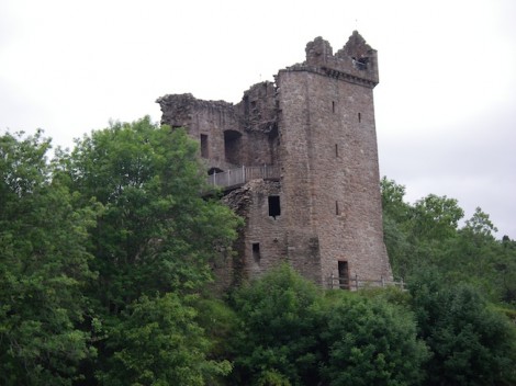
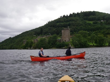
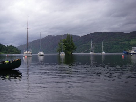
The group had asked that we cross back over to the Western shoreline in order that they could have a better look at Urquhart Castle. Though now extensively ruined, the castle was in its day one of the largest strongholds of medieval Scotland. It is also near here that the majority of the sightings of Nessie occur!
So the plan now was to head further up the Eastern shore to Inverfarigaig before crossing back over to the castle. The wind was now quite fresh, and as we set off across it became apparent that one of the tandem crews was having directional issues. My only option was to take their painter and tow them the 1.5 km or so to the other side. Trim is really important when paddling canoe, especially in windy conditions. It can make the difference between a good day or a bad one.
Urquhart Castle
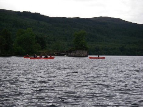
After a short stop for lunch we continued on our way. Whilst crossing Urquhart Bay a strong gust of wind came in from our left. This very quickly carried one of the boats plus the boat it was towing over 1 km out into the loch. Beware of strong of wind gusts funneled in by the shape of the valleys and surrounding land mass.
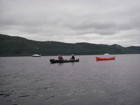
The boat that was blown away
Once re-grouped we continued on our way. The plan now was to get a pick up from Dores, just short of the end and back on the eastern side. It’s a long story as to the reason why we would have to cross the loch again!
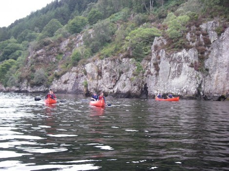
A sheltered and more relaxed paddle
The end in sight and Dores over to the right
The wind again picked up, and as had always been the case so far not going in our direction. As we neared Dores this wind had become quite fresh, so we made the most of any shelter created by the shore and stayed close in. The prospect of another crossing didn’t particularly excite me, especially after having had to tow a boat in the morning and the fact that people were now starting to feel a bit fatigued. Add to this the fact the crossing would be around 2 km or more, so we made a quick stop for a brew and I concocted a new plan. I made a quick call to our pick up and instead arranged them to meet us on the beach at Lochend.
Despite the fact that it appeared we were paddling into wind the clouds behind were getting darker and thicker. In fact it almost appeared what was behind us may be catching us up!
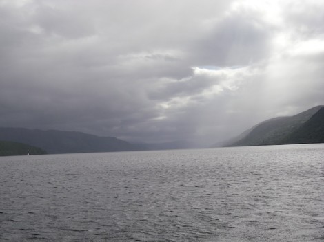
The clouds fast catching us up
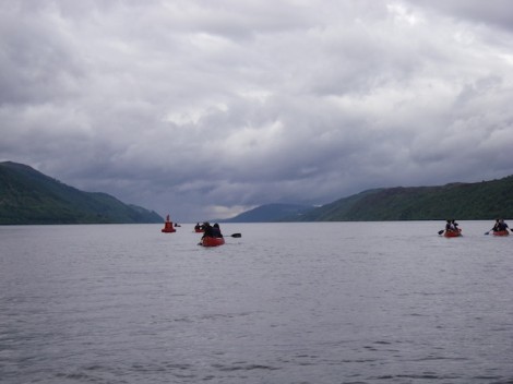
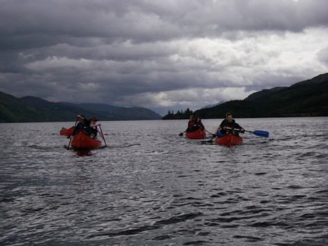
As is quite often the case when you have spent all day paddling into the wind, it suddenly changed direction and gave a slight helping hand for the last km or so. As the beach in the distance grew closer there was a certain air of success amongst the group . Only two days previously it had been a real challenge for them to paddle a few hundred metres with any hint of real control and for some it had been their first time ever in an open canoe. Now they had some 23 miles of water behind them and they really could say that they had paddled from end to end on Loch Ness.
Our finish point, the beach at Lochend
I would recommend this trip to anyone who enjoys touring/journeying in open canoe. It can either be done as the trip described or as a part of the Caledonian Canal if looking for a longer trip l. There are lots of opportunities for wild camping, but I would recommend keeping this to the eastern side of the loch, as the A82 runs very close along the western shore potentially making for a noisy camp. The weather can really play a big part in this trip, and effect the outcomes. As mentioned the waves or swell can be quite big with the potential for swamping the boat. Make sure you check the forecast in advance and if in any doubt wait for better weather.
Well done to the group and I hope that during the week I manged to inspire and enthuse you enough about open canoeing that you will, if you haven’t already done so go and have your own canoe adventures.
See you on the water…
Jules
www.voyageur-coaching.co.uk
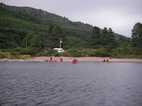
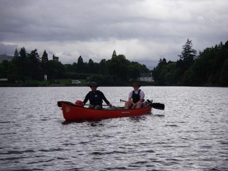
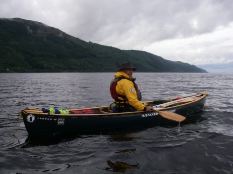
I was recently asked to spend a week introducing a group of people to Open Canoeing in the Scotland. After having spent only a day and a half getting to grips with the basics as a tandem crew, I decided that it was time to venture a little further and attempt a two day journey with an over night camp. What better way to learn about the subject than by simply going and doing it? After a brief chat with my group whilst traveling back from a day on Loch Ussie, a unanimous decision was reached. The journey/camp was to be on the classic Loch Ness.
Loch Ness is a very large, and very deep fresh water loch in the Scottish Highlands, and is part of a cross Scotland route know as the Caledonian Cannal which in its self is part of the Great Glen. It lies South of Inverness and is some 23 miles (37km) in length. Despite its size it is the second largest Scottish loch by surface area after Loch Lommond . It is probably best know for the alleged sightings of the legendary Loch Ness Monster, otherwise know as ‘Nessie’.
I feel the open canoe can really come into its own when introducing people to paddlesport. It is a great way to encourage teamwork, communication and trust especially when tandem crews are used. Not only that but it really doesn’t take that long to give people the basics to get going and then head off on some journeys.
Looking out from our start point towards Cherry Island
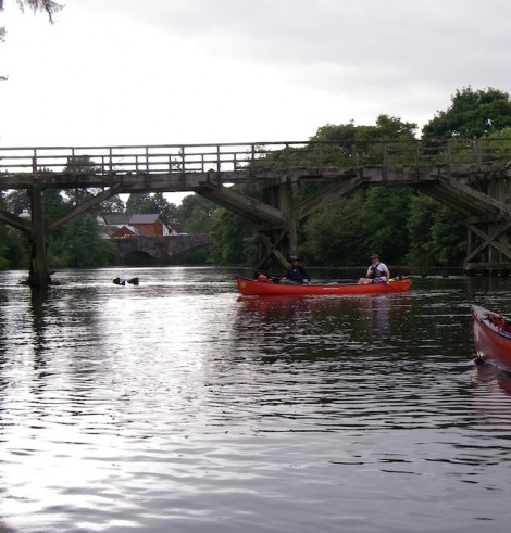
Passing the old pier
Our drop off point was not far outside Fort August on a midge infested slipway looking out to Cherry Island, which is the only Island on Loch Ness. Although all that can be seen today is a rocky tree clad island, it is in fact man made and known as a crannog.
Midges don’t normally bother me too much but these were really bugging me! So we quickly unloaded the boats and kit and had a chat about our options. The decision was made that in order to claim we had truly paddled from end to end, we would firstly have to head back towards Fort Augustus to where the River Oich entered the loch and a small wooden bridge crossed it. After a brief stop we turned around and started to head North. 23 miles of open water now lay between us and the end!
Heading back to Fort Augustus & the River Oich
Our true start point, the bridge over the River Oich
We made our way up the Western side of the Loch past Port Clair and on to Invermoriston where the River Moriston flows into the loch. Unfortunately any wind that was present was blowing in the wrong direction, so any chance of a helping hand or the opportunity for a sail was out of the question. The wind on the loch can pose quite a problem for the paddler, as there is potentially a long fetch (distance the wind can travel over the water) and the swell or waves created can easily swamp a canoe, so care should be taken.
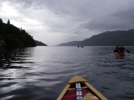
23 miles of water between us and the end!
The group heading North
My well laden boat
Passing Port Clair
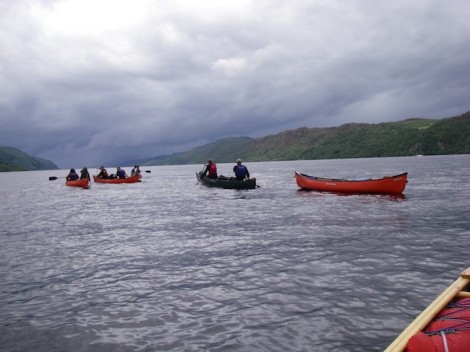
One of the many stops
Port Clair and Invermoriston were now some distance behind us and we didn’t appear to making as much ground as I had hoped. To make things worse as we headed for Alltsigh we could see a storm in the distance which was definitely heading our way.
The darkening clouds offering us warning of what was to come!
Brighter weather followed
Not sure if its a good thing or not that you can see what’s coming, I mean do you really want to know that very soon your going to get very wet! Sure enough about twenty minutes later it hit us head on. Strong squally winds and torrential rain. This forced us to stop and take refuge in the trees along side. The group produced some hot food and entertained themselves whilst I decided on a plan of action. As if by magic after forty minutes or so it stopped and the sun broke through. It was now getting quite late with not much light left so we quickly packed up and set off, crossing to the Eastern side and heading for Foyers where I had planned to camp for the night. This would then mean that we were as good as half way.
Heading for the Eastern shoreline
Me half way across
Smiling faces and better weather over on the Eastern shore
Once we had safely crossed to the other shore a short paddle brought us to Foyers. After a quick recce I found a nice little sheltered beach not far from where the River Foyers enters the Loch.
River Foyers
Not long after landing the group had set up camp and had got some food on the go. They had opted to use tents, but as usual I had gone for a boat and tarp combination. I rarely use tents if I can help it, as tarps are alot more flexible and rather more in keeping with the traditions of the open canoe. With some thought and experimentation a good shelter can be produced that will protect you well in the most challenging conditions. In this case because I chose to camp on the beach I used my split canoe pole to form a frame. Due to the stony environment of the beach tent pegs weren’t an option, so instead I tied my guy-lines onto pieces of driftwood I had found and buried them under large piles of stones. I like to use waterproof cotton tarps as opposed to nylon. My main reason being that if I choose to use an open fire for heat and cooking there is less of a chance that holes will be created by random sparks.
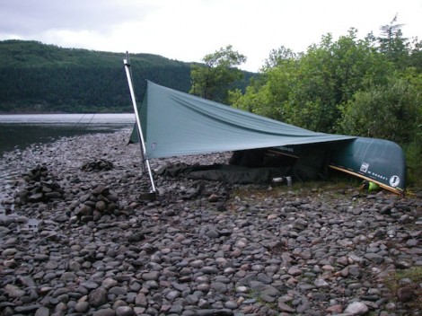
Home sweet home
After a good meal I decided to explore the local area a little before hitting the sack. I had noticed quite a strong aroma from around the area of my tarp and it didn’t take long before I found its source. Just behind where I had pitched was some wild mint, so it made sense to have a quick brew of mint tea before bed.
With the sun setting I was happy in knowing that we had at least made it half way. I was left with thoughts of what the following day would offer, or more importantly what the weather would throw at us?
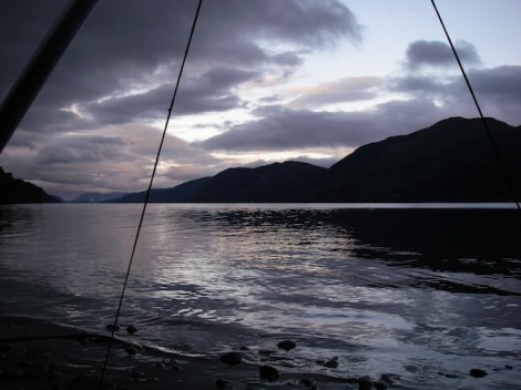
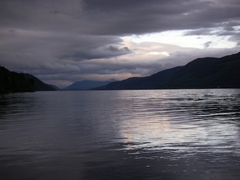
I will leave you with this parting shot.
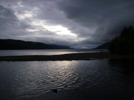
Sunset over Loch Ness from Foyers
To be continued…
See you on the water ….
Jules
www.voyageur-coaching.co.uk
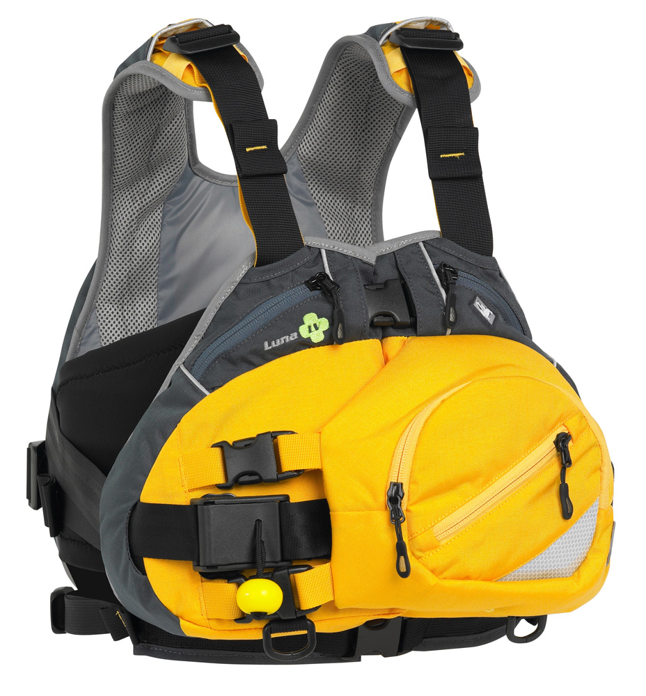
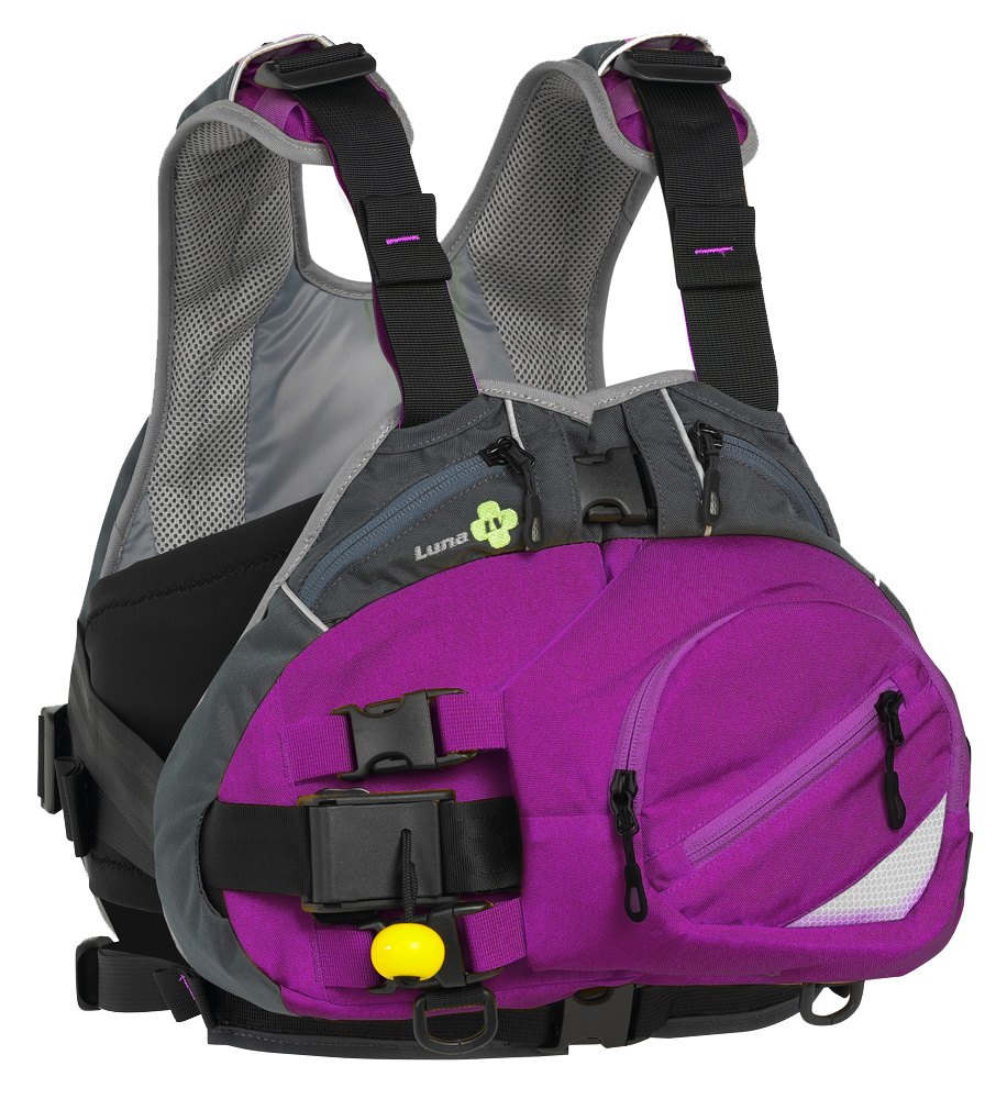
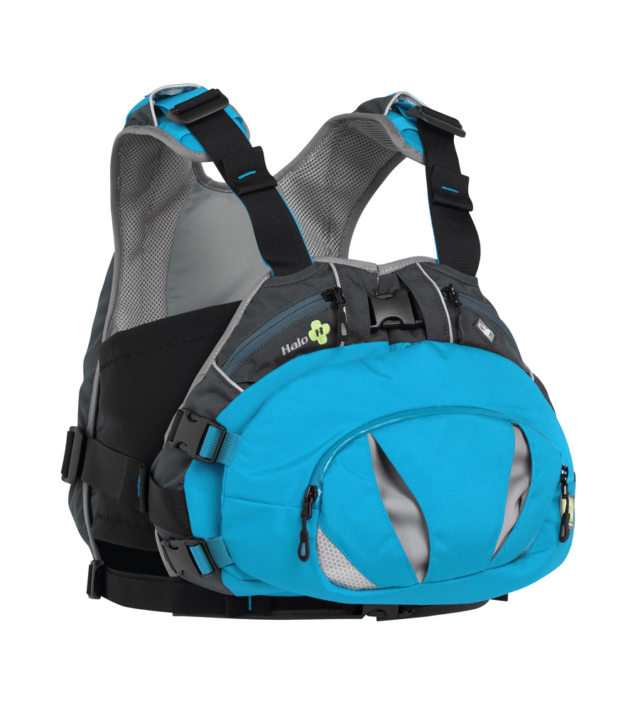
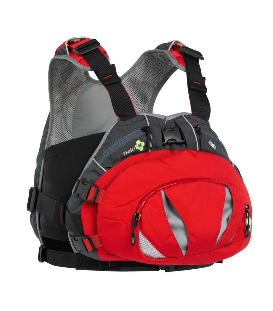
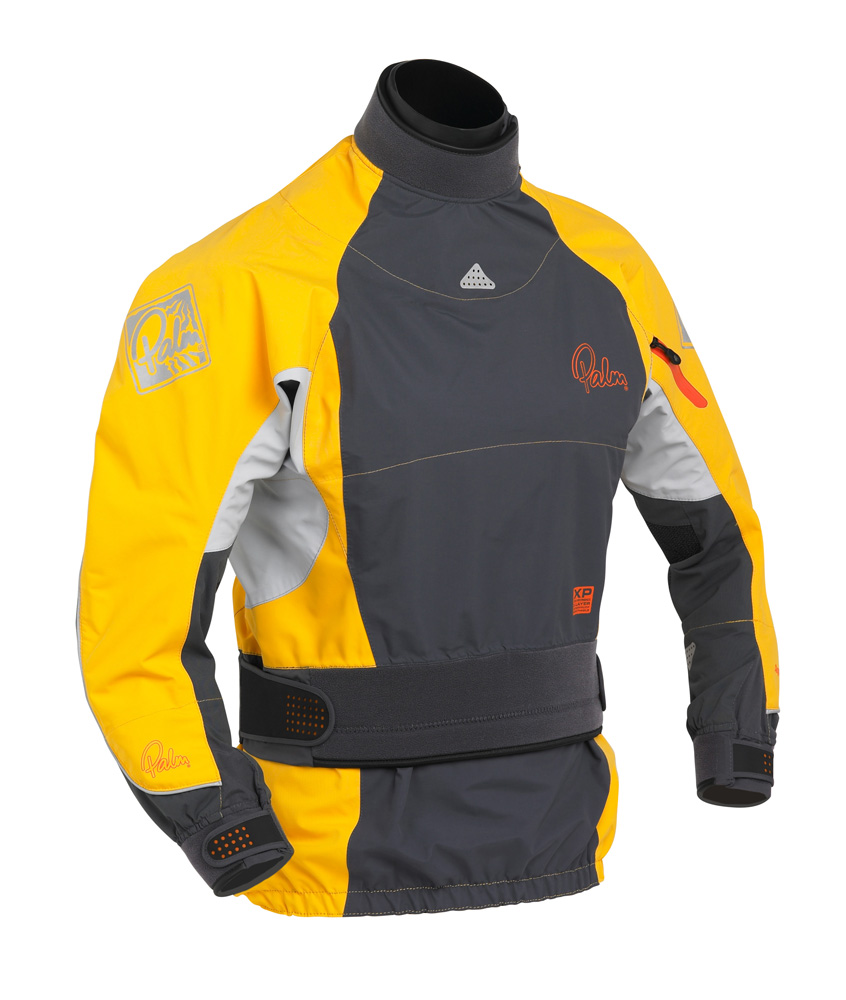
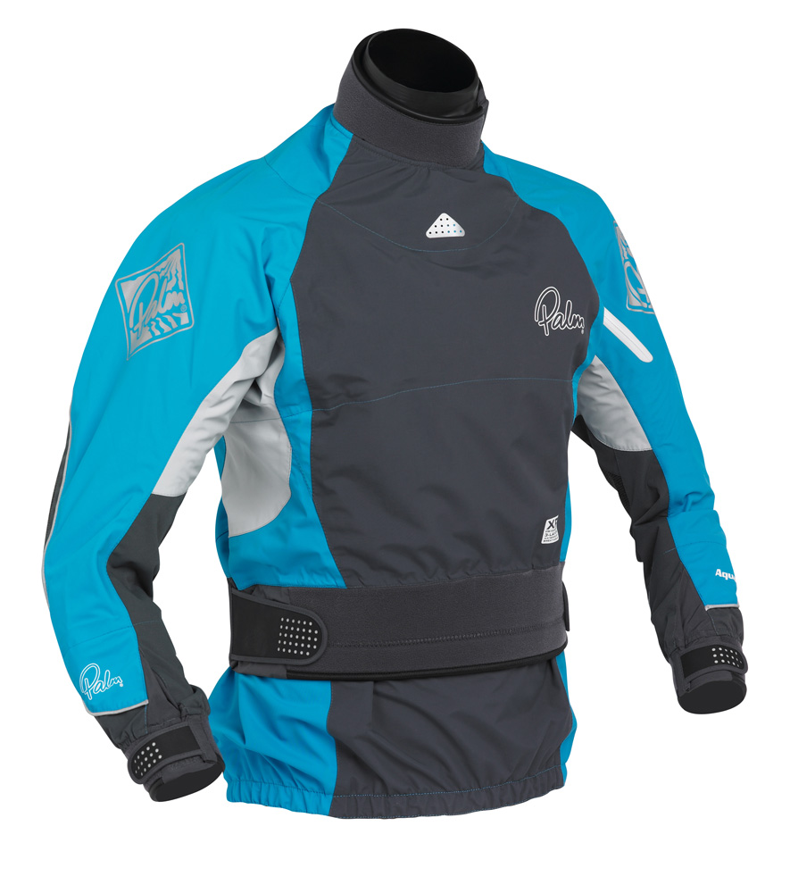
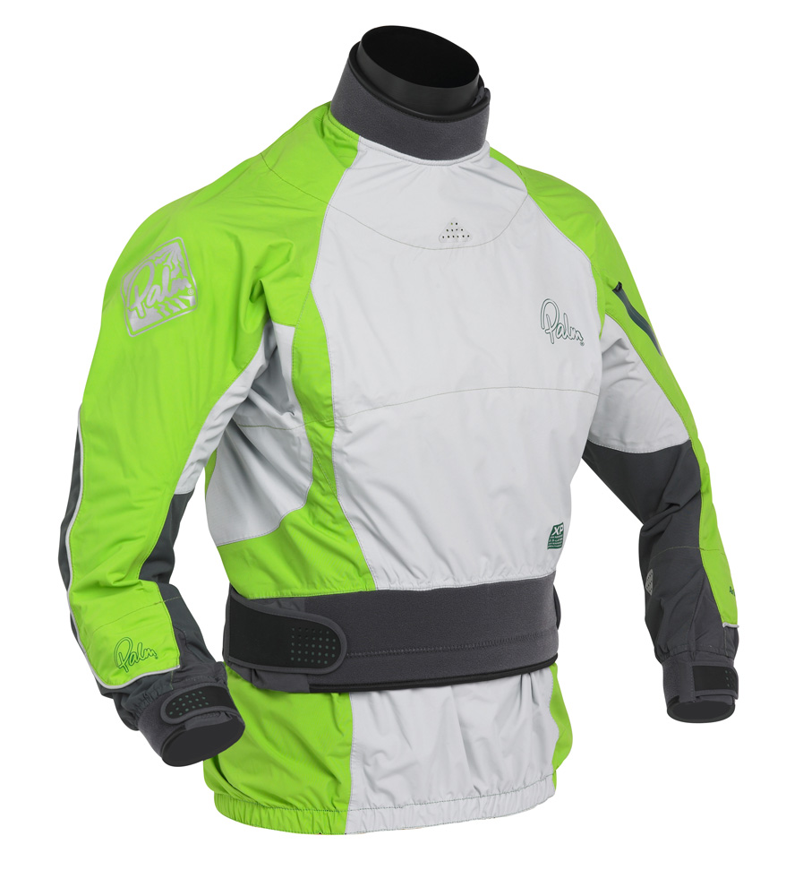
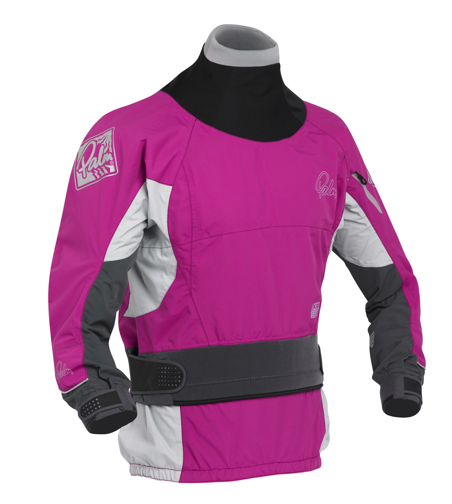
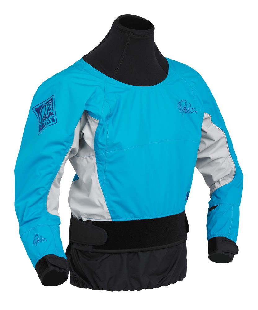
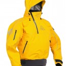
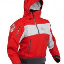
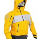
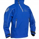
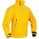
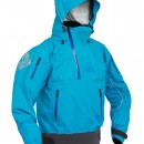
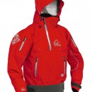
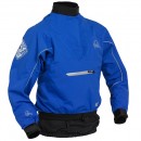
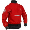
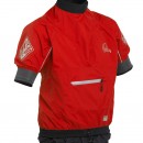
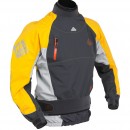
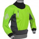
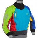
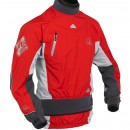
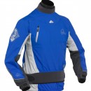
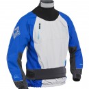
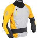
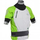
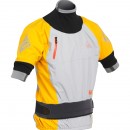
This morning we released the 2011 Palm Equipment Workbook.
Packed with new designs and exciting colours, the range includes 4 women’s whitewater jackets, 5 men’s whitewater jackets and 6 new touring jackets.
Check it out below or online here:
2011 Palm Workbook
Keep checking back here for more updates from the Kanumesse Show or find Palm on facebook.